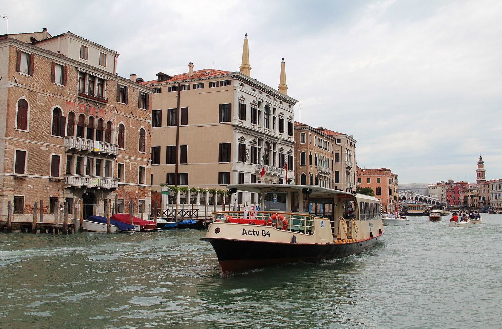
The historic city is compact: the walk from the railway station to St Mark’s takes well under an hour. Boats do the rest, carrying residents, visitors, groceries and ambulances along the same canals.
On foot through the city
Walking is how most people get about, residents included. The road from the mainland stops at Piazzale Roma and the railway at Santa Lucia station; beyond them there are no cars or scooters, and cycling is not allowed. Instead there is a dense web of calli (alleys), campi (squares) and fondamente (quays), stitched together by more than 400 bridges, most of them short stone spans with a few steps on each side.
Finding the way is easier than its reputation. Yellow signs on street corners point towards the big landmarks, per Rialto, per S. Marco, alla Ferrovia, per P.le Roma, and street names are painted on the walls in black on white rectangles, the nizioleti or ‘little sheets’. House numbers run through each sestiere, the six districts of the city, rather than street by street, so an address gives you the area but not the street. Ask for the nearest campo or water-bus stop as well.
Keep right in narrow calli, step aside before you stop to read a map, and never halt on the crown of a bridge: these are the city’s main roads.
The water-bus network
The public water buses are the backbone of the city’s transport. Venetians call them all vaporetti, after the small steamers that appeared in 1881, though the fleet also includes lower, quicker motoscafi on the routes round the city and larger motor ships on some lagoon crossings.
Reading a stop
A stop, or fermata, is a floating pontoon, the pontile or imbarcadero, joined to the quay by a hinged ramp so that it rises and falls with the tide. Larger stops have several pontoons labelled with letters, each serving different lines. Before boarding, read the sign on the pontoon itself: it gives the line number and the direction, usually as the terminus or the next major stop. The same line often calls at a stop in both directions, from different pontoons.
Circular lines run both ways
The lines that ring the city come in pairs that share a number; on the current network the .1 line runs anticlockwise and the .2 line clockwise. Boarding the wrong one can mean a very long way round, so ask the crew if in doubt. On the Grand Canal a slow line stops at almost every landing and a faster one skips several. The slow boat is the best way to see the palaces, as the Grand Canal chapter explains.
The main hubs
| Hub | Where | Useful for |
|---|---|---|
| Piazzale Roma | End of the road from the mainland | Airport buses; Grand Canal and circular lines |
| Ferrovia | Santa Lucia station | Grand Canal and circular lines |
| Rialto | Rialto Bridge | The middle of the Grand Canal |
| San Marco, San Zaccaria | Basin of St Mark’s | The Lido, Giudecca, San Giorgio |
| Fondamente Nove | Northern Cannaregio | San Michele, Murano, Burano, Torcello |
| Lido S. M. Elisabetta | Lagoon side of the Lido | Buses towards Pellestrina |
| Tronchetto | Beside the car parks | Car ferry to the Lido; shuttle train to Piazzale Roma |
On board
Boats stop only briefly: a deckhand throws the rope, slides the gate open and closes it again within a minute or so.
- Let people off firstWait beside the gate of the pontoon, not in front of it.
- Move insideThe space by the gate is needed by those getting off at the next stop.
- Take your backpack offOn a crowded deck it hits faces.
- Keep luggage out of the wayUse the luggage space where there is one; the operator sets limits on size and number.
Boats are fullest early in the morning and late in the afternoon, when commuters travel between the mainland and the city. On the Grand Canal the crush begins in mid-morning, as day visitors head from Piazzale Roma and the station towards Rialto and St Mark’s, and reverses in the late afternoon. When a boat is packed, waiting for the next one, walking part of the way or taking a circular line is often quicker.
Traghetti: gondola ferries
With only four bridges over the Grand Canal, a crossing by boat can save a long walk. The traghetto is a plain gondola rowed by two gondoliers from bank to bank in a couple of minutes. There were once dozens of crossings; today only a few operate, some only at certain hours or in certain seasons. Those at Santa Sofia, opposite the Rialto market, and at San Tomà are among the most regular.
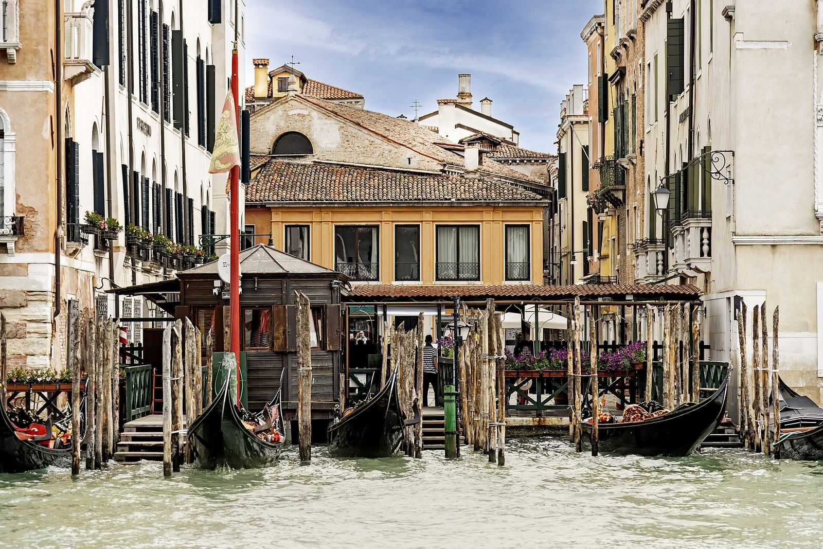
Look for a yellow sign with a black gondola at the end of a calle. Step down carefully and keep your weight low. Venetians traditionally cross standing up, but sitting on the side bench is perfectly acceptable.
Gondolas and water taxis
Gondolas
A gondola ride is for seeing the city rather than getting somewhere. The boats work from official stations, the stazi, and are rowed by some 400 licensed gondoliers. Agree the length and route of the ride before you step in.
Water taxis
Water taxis are fast launches that take a small group and its luggage to the water entrance of a building or the nearest landing. Use licensed boats only: they wait at official ranks at the station, Piazzale Roma, Rialto, St Mark’s, the Lido and the airport, and carry a yellow stripe with the city’s emblem and a licence number. Confirm the destination and the conditions of the journey before you set off.
How to get there: airport, rail and road
Marco Polo airport lies on the mainland at Tessera, about 7.5 km north-east of the historic city. From arrivals, buses cross the causeway to Piazzale Roma, and a covered walkway of about ten minutes leads to the water landing, where public boats leave for the city and licensed water taxis wait. Trains run into Santa Lucia station, on the Grand Canal, almost all of them via Mestre. Drivers leave their cars at Piazzale Roma or on Tronchetto.
Route card
AirporttoPiazzale Roma
Tip
The water-bus pontoons are a short walk from the bus stands.
Route card
AirporttoSan Marco
Tip
Some boats call at Murano and the Lido. Choose the landing nearest to where you are staying.
Route card
MestretoSanta Lucia
Tip
The station steps lead straight down to the Ferrovia water-bus stops.
Route card
Piazzale RomatoSan Marco
Tip
The slow Grand Canal line doubles as a first tour of the city.
Times are typical and timetables change: check the official information of the airport and the public transport operator before you travel.
Travelling without steps
Bridges make Venice hard going with a wheelchair or a pushchair, but the water buses change the picture. Almost every pontoon floats at deck level and most boats have space for wheelchairs, so by hopping between level stretches of quay a large part of the centre, well over half by the city’s own estimate, can be reached without crossing a bridge. The City of Venice publishes maps of these areas with suggested itineraries.
Bear in mind that the ramps to the pontoons grow steep at very high and very low tides, that crews may ask for a companion on some boats, and that only a few bridges have ramps. The Lido, with its roads and buses, is easier still.
Safety, tides and night boats
Passing boats send wakes slapping against quays and pontoons, and a moored boat can lurch just as you step across. Hold the rail, cross in one movement and wait for the crew’s signal.
From autumn to early spring, high tides can flood the lowest areas for a few hours. Sirens sound in advance, raised walkways go up on some main routes, and extreme tides can divert boats or close stops. The MOSE gates at the inlets have held back the highest tides since 2020, but St Mark’s Square can still flood; the tides chapter explains why.
Night boats
Water buses run all night, but on far fewer routes and much less often. From around midnight a night line links the Grand Canal with the Giudecca and the Lido. Before an evening on an island, check when the last convenient boat leaves.
Luggage
Wheeled cases and stone steps do not mix. Choose a route with few bridges, lift your case rather than bumping it down each flight, or take a boat to the stop nearest your door. Licensed porters work at the main arrival points.
Questions
Can I walk everywhere?
Within the historic city, yes: Rialto to St Mark’s takes about ten to fifteen minutes. The islands, Giudecca and San Giorgio included, can only be reached by boat.
How do I get to Murano and Burano?
Boats leave from Fondamente Nove: Murano is about ten minutes away, Burano roughly 40–45 minutes. The Murano and Burano pages have route cards, and the islands overview shows how they fit together.