The historic city already stands on about 118 islands, but that is not what people mean by “the islands”. They mean the separate places scattered across the lagoon, each reached by boat and each with its own reason for being there.
How the islands group
Geography and history sort the islands into a few families. Knowing which family an island belongs to tells you a good deal about what you will find there, and how easy it will be to reach.
City islands
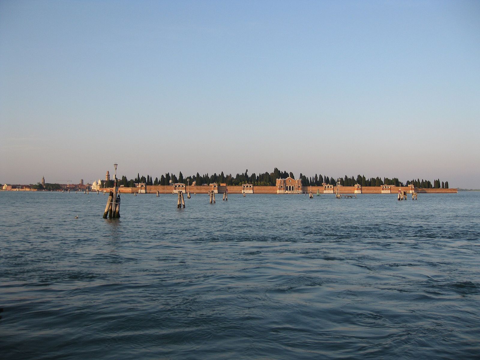
Giudecca and San Giorgio Maggiore lie a few minutes across the water from the centre and are, in practice, part of the city. San Michele, the walled cemetery between Fondamente Nove and Murano, belongs with them.
The northern lagoon
Murano, Burano, Mazzorbo and Torcello were settled early, some of them before Venice itself became the dominant centre, and each still has its own church, square and character. Around them lie the flat market-garden islands of Sant’Erasmo and Vignole, which still grow vegetables for the city.
The southern barrier islands
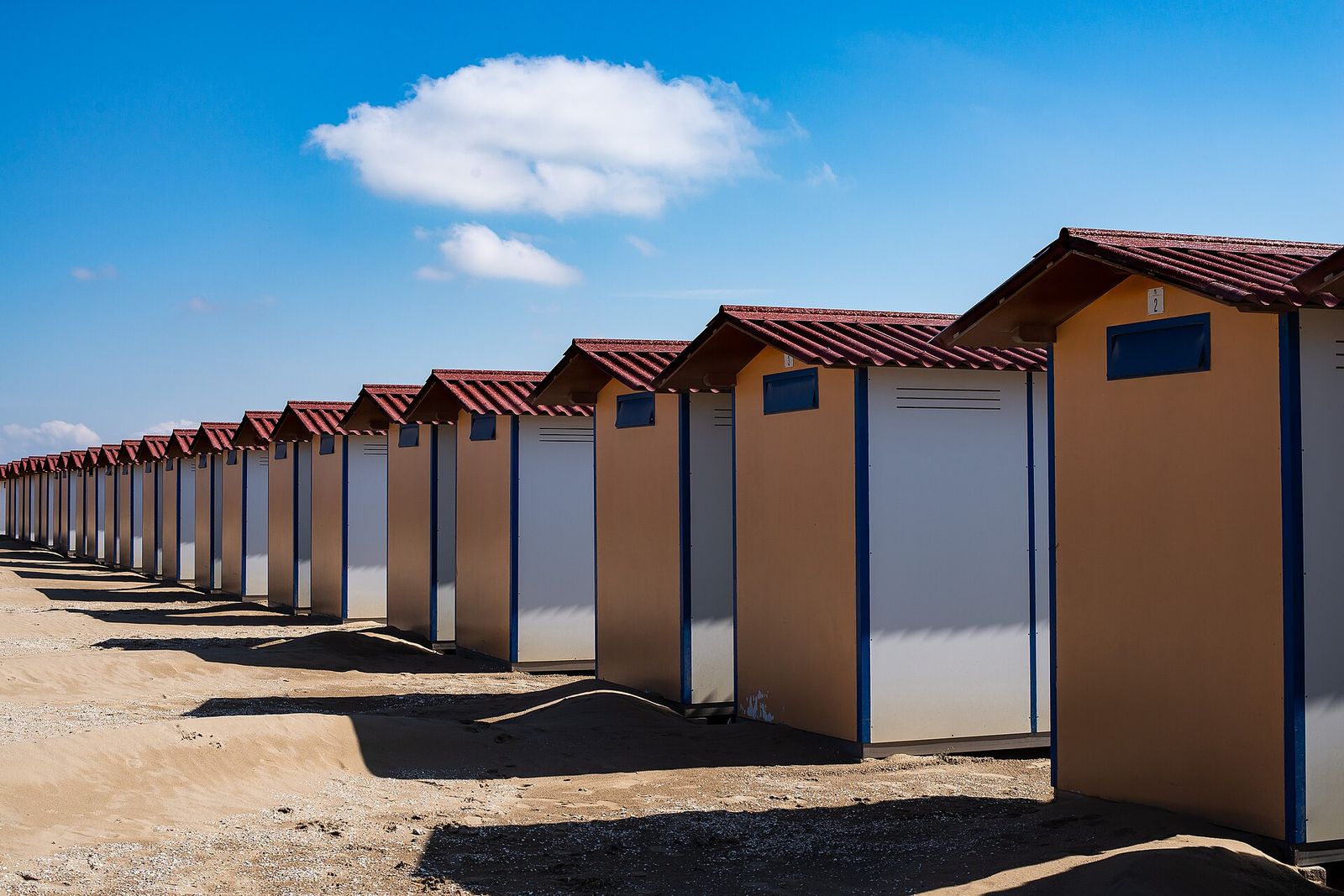
The Lido and Pellestrina are lidi: long bars of sand between the lagoon and the open sea, defended on their seaward side by walls and breakwaters. They have roads, cars and buses, which makes them feel very different from the rest of the lagoon. Chioggia, a town of fishermen and canals, closes the lagoon at its southern end. The lagoon chapter explains how these sandbars formed.
Monastery islands
For centuries the Republic handed small islands to religious orders. Some communities are still there: Armenian monks on San Lazzaro, Franciscan friars on San Francesco del Deserto. Others, such as San Servolo and La Certosa, lost their monks in the early nineteenth century and have since found new uses.
Closed and abandoned islands
Hospitals, quarantine stations, forts and powder stores were also sent out to islands, as far from the crowded city as possible. Many were abandoned in the twentieth century. You will see them from the deck, but landing on most of them is not allowed.
Close to the city
These islands are a short crossing from the centre and fit easily into half a day.
Giudecca
A long, curving island across the wide Giudecca Canal from the Zattere: former factories and boatyards, gardens behind high walls, ordinary housing and, facing the city, Andrea Palladio’s Redentore church. Each July a temporary bridge on pontoons links it to the Zattere for the Redentore festival. The Giudecca and San Giorgio chapter has more.
Route card
ZatteretoGiudecca
Tip
Walk the fondamenta along the northern shore: it looks straight back at the city across the canal.
San Giorgio Maggiore
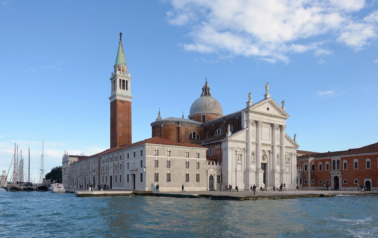
A small island taken up almost entirely by Palladio’s white church and its former Benedictine monastery. The view from the bell tower, over the basin of St Mark’s, the Doge’s Palace and the rooftops beyond, is one of the best in Venice.
Route card
San ZaccariatoSan Giorgio
Tip
Come in the afternoon, when the sun falls on the waterfront of the Doge’s Palace opposite.
San Michele
Since 1807, under Napoleonic rule, San Michele has been the city’s cemetery, and the dead are still taken there by boat. A long brick wall encloses it; inside, avenues of cypress run between family chapels and numbered fields. Space is so short that most graves are not permanent. By the landing stands San Michele in Isola, designed by Mauro Codussi in 1469 and often called the first Renaissance church in Venice. Igor Stravinsky, Sergei Diaghilev, Ezra Pound and Joseph Brodsky are buried here.
Route card
Fondamente NovetoSan Michele
Tip
The stop is called Cimitero. This is a working cemetery: dress and behave as you would at any burial ground.
La Certosa
A Carthusian monastery stood here until the Napoleonic years, when the monks were removed, the art carried off and the island handed to the military. A powder store and a pyrotechnics works followed, and decay set in after they closed in the mid-twentieth century. Since the late 1990s the island has been slowly reclaimed as a green space, with boatyards and sailing at its southern end.
Route card
Fondamente NovetoLa Certosa
Tip
Boats call at Certosa on request. Tell the crew when you board, and check how to signal the boat for the return.
The northern lagoon
North of the city the water is shallower, the navigable channels are marked by lines of wooden piles, the bricole, and the boats run less often. Most trips start from Fondamente Nove, on the city’s northern shore.
Murano
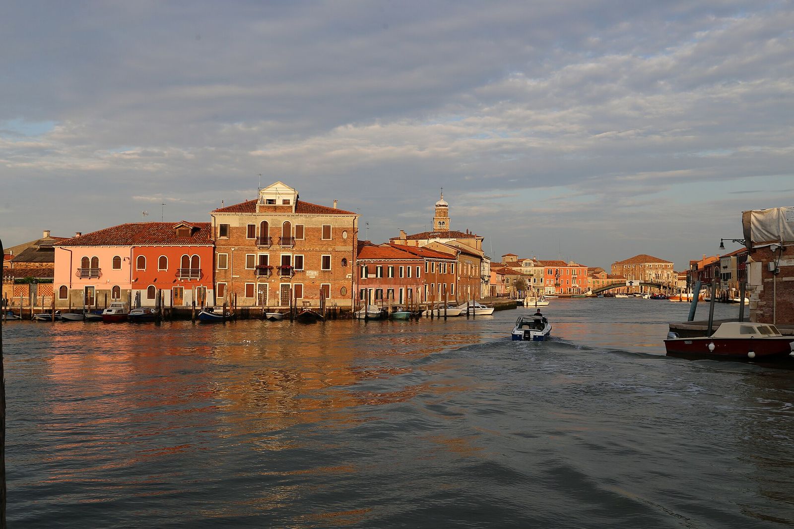
The closest of the northern islands and the busiest. The glass furnaces arrived in 1291, and glass is still worked here. Beyond the showrooms, look for the Glass Museum and the twelfth-century mosaic floor of Santi Maria e Donato. The Murano chapter has the details.
Route card
Fondamente NovetoMurano
Tip
Murano has several stops. Colonna is closest to the Rio dei Vetrai, Museo to the museum and the basilica.
Burano
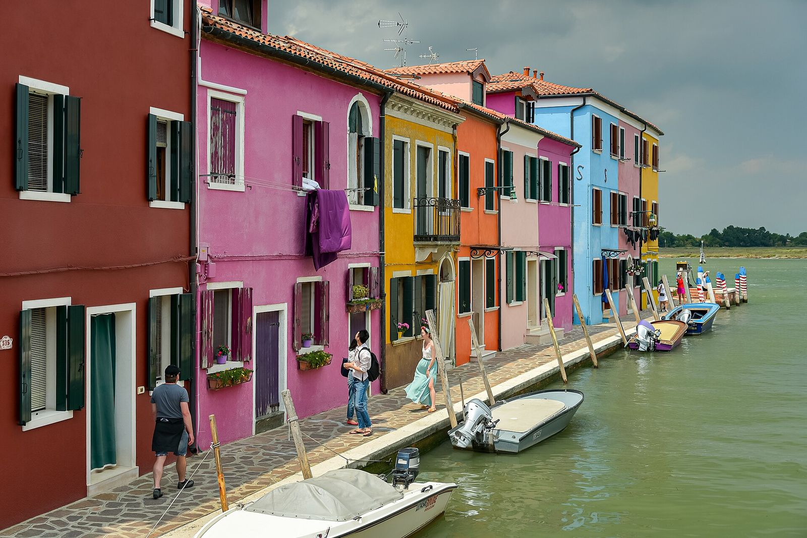
The farthest of the popular islands and the most photographed, for its houses painted in strong, deliberate colours along narrow canals. It has long been an island of fishermen and lacemakers, and its leaning bell tower can be seen from far across the lagoon. See the Burano and Mazzorbo chapter.
Route card
Fondamente NovetoBurano
Tip
Boats to Burano call at Murano on the way, so you can break the journey there.
Mazzorbo
Joined to Burano by a wooden footbridge, Mazzorbo was once a busy trading island with five monasteries and five parish churches. Only Santa Caterina survives. Today the island is quiet: kitchen gardens, orchards, a walled vineyard and a colourful housing quarter designed by Giancarlo De Carlo to bring residents back.
Route card
Fondamente NovetoMazzorbo
Tip
Get off at Mazzorbo and walk over the bridge: you reach Burano from its quietest side.
Torcello
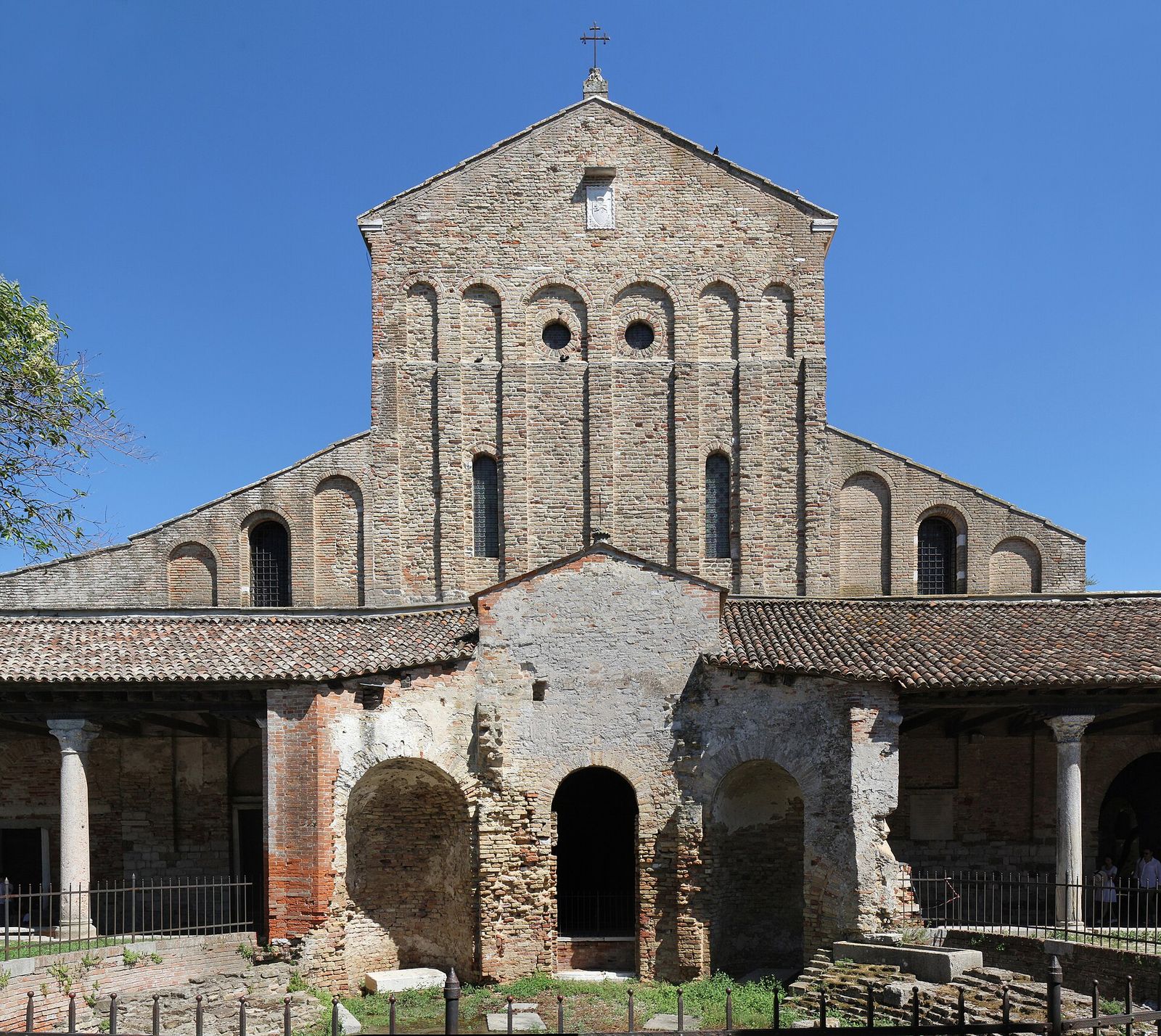
Torcello was once the leading settlement of the lagoon, with a bishop, a cathedral and busy wharves. As its channels silted up and malaria spread, people moved away, and only a handful live there now. The cathedral of Santa Maria Assunta, founded in 639, keeps its great Byzantine mosaics. Read the Torcello chapter.
Route card
BuranotoTorcello
Tip
Note the last boat back to Burano before you set off along the canal path to the cathedral.
San Francesco del Deserto
A small green island of about 4 hectares between Burano and Sant’Erasmo. Francis of Assisi is said to have landed here in 1220 on his way back from the Holy Land, and Franciscan friars still live in the friary that grew up on the spot. There is no regular water-bus service.
Route card
BuranotoSan Francesco del Deserto
Tip
The friars receive visitors only at set times. Check before you arrange a boat.
Sant’Erasmo
One of the larger islands in the lagoon and one of the least visited: long, flat and green, with market gardens, a few hundred residents and almost no traffic. It is known for its violet artichokes; the first tender buds of spring, the castraure, are a Venetian delicacy. At its southern tip stand the Torre Massimiliana, a fort built under Austrian rule in the 1840s, and a small beach popular with Venetians in summer.
Route card
Fondamente NovetoSant’Erasmo
Tip
The island has three stops spread along its length. Distances on foot are longer than they look, so carry water.
Vignole
Two small islands joined by a bridge, home to a small farming community and a little church with a bell tower. The eastern part is a military zone; beyond it, on its own islet, the sixteenth-century Forte di Sant’Andrea guards the Lido inlet.
Route card
Fondamente NovetoVignole
Tip
Vignole lies on the same route as Sant’Erasmo, so the two combine well for a quiet half day.
Lazzaretto Nuovo
In 1468 the Senate turned this walled island, until then a vineyard, into a quarantine station for ships, crews and goods bound for Venice. Its great warehouse, the Tezon Grande, more than 100 metres long, still carries sixteenth-century inscriptions left by the men who handled the cargo. After the military left in the 1970s, volunteers cleared and studied the site, and they now show visitors round on set days in the warmer months.
Route card
Fondamente NovetoLazzaretto Nuovo
Tip
Visits are guided and must be arranged in advance with the volunteers who look after the site.
Towards the Lido
Between St Mark’s and the Lido lies a string of small islands that the Republic once gave to monks, to the sick and to the quarantined.
San Servolo
Benedictine monks lived on San Servolo for centuries. In the eighteenth century the Republic made it the site of a hospital, which later became the city’s psychiatric hospital until it closed in 1978. The buildings now house a university campus and meeting rooms, and a small museum recalls the asylum years. The gardens grew out of the plants once grown for the hospital pharmacy.
Route card
San ZaccariatoSan Servolo
Tip
San Servolo and San Lazzaro are on the same route, a few minutes apart.
San Lazzaro degli Armeni
A medieval leper colony, later abandoned, San Lazzaro was granted in 1717 to Mekhitar and his community of Armenian Catholic monks, who still live there. Their library and museum hold thousands of Armenian manuscripts and an unexpected range of curiosities, an Egyptian mummy among them. Lord Byron came over regularly in the winter of 1816–17 to study Armenian with the monks; the room where he worked bears his name.
Route card
San ZaccariatoSan Lazzaro
Tip
The monks guide visitors at set times. Check before you go, and plan your boat around the visit.
Lazzaretto Vecchio and Poveglia
Lazzaretto Vecchio, close to the Lido, became a plague hospital in 1423, one of the earliest permanent ones in Europe. Since 2004 archaeologists have uncovered the remains of more than 1,500 plague victims there. The island is not open for casual visits, although occasional guided openings have been organised.
Poveglia, between the city and the Lido, was a fishing and salt-making community in the Middle Ages, then a quarantine station and, until 1968, a care home. It has been closed and decaying for decades; a citizens’ association has recently been granted part of it for a future public park. The stories of mass graves and hauntings attached to it come from television rather than from the archives.
The southern barrier
South of the city, the Lido and Pellestrina each run for about 11 km between lagoon and sea. A bus, a short ferry and a boat link them to Chioggia, which makes a long but rewarding day.
Lido
A sandbar with beaches on the Adriatic side, tree-lined avenues, early twentieth-century villas and the Venice Film Festival, held here since 1932. Unlike the historic city, it has cars and buses. See the Lido and Pellestrina chapter.
Route card
San ZaccariatoLido S. M. Elisabetta
Tip
From the landing, the main avenue leads straight across the island to the sea in about a quarter of an hour on foot.
Pellestrina
A narrow strip of sand with four fishing villages of brightly painted houses facing the lagoon. On the sea side runs the Murazzi, the massive stone sea wall that the Republic built in the eighteenth century to keep the Adriatic out of the lagoon.
Route card
Lido S. M. ElisabettatoPellestrina
Tip
The bus boards a short ferry across the Malamocco inlet, one of the lagoon’s three openings to the sea.
Chioggia
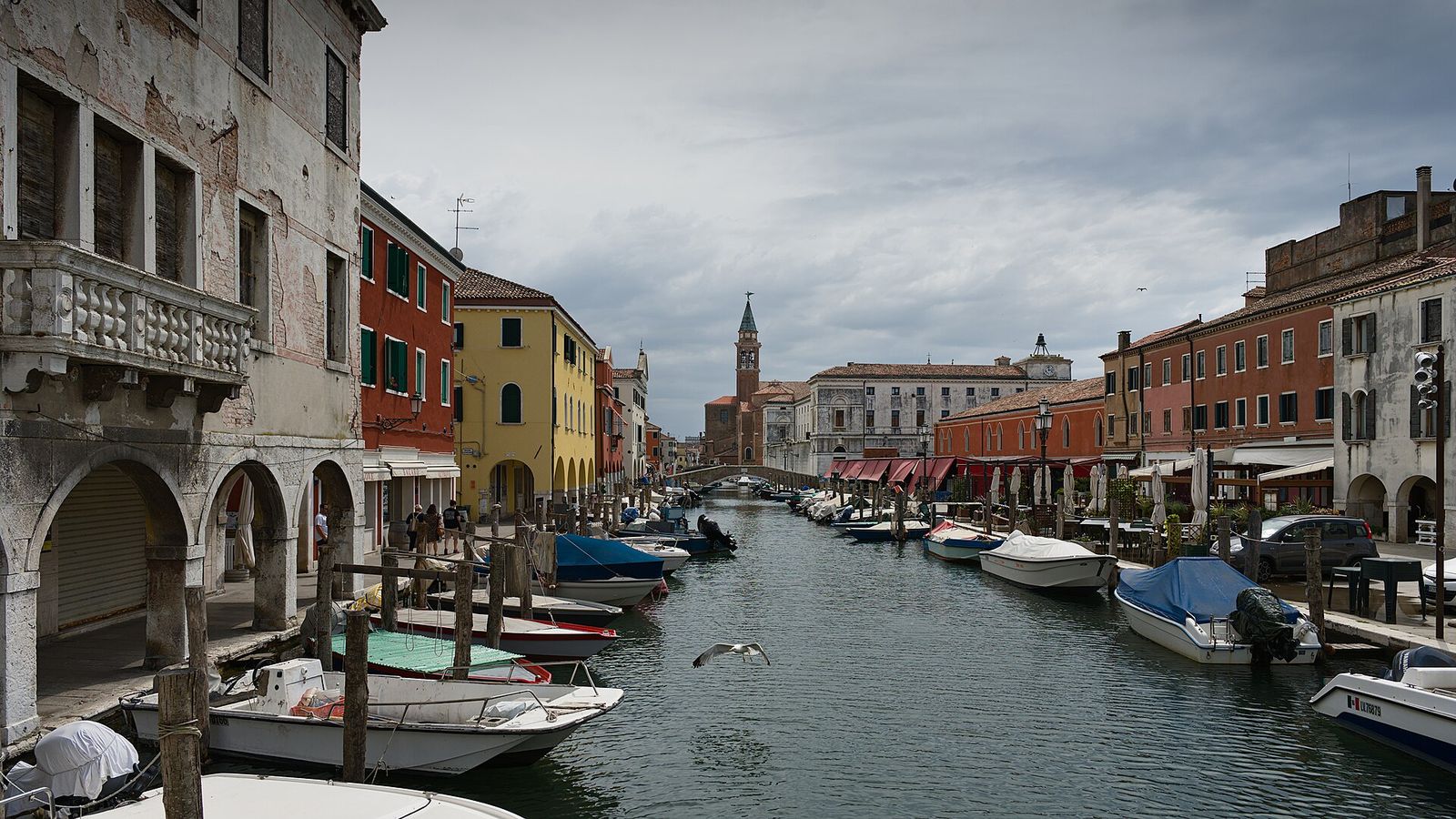
At the southern end of the lagoon, about 25 km from Venice, Chioggia is a town in its own right, with around 50,000 people in its municipality. Built on islands and crossed by canals, it looks like a smaller, more workaday Venice. Fishing has always been its living: the Canal Vena is lined with working boats and arcaded houses, and the long Corso del Popolo runs through the middle of the old town.
Route card
PellestrinatoChioggia
Tip
To return without retracing your steps, buses link Chioggia with Piazzale Roma by road in about an hour.
Day plan: Murano, Burano and Torcello
Both day plans on this page assume an early start and a return in the early evening. Boats on the outer routes run less often than in the city, so check the timetable for each leg before you leave, and keep the last boat back in mind.
-
Morning
Fondamente Nove to Murano
A ten-minute crossing. Walk the Rio dei Vetrai, then see the Glass Museum and Santi Maria e Donato before the island fills up.
-
Late morning
On to Burano
Boats from Murano’s Faro stop continue north to Mazzorbo and Burano in roughly half an hour. Get off at Mazzorbo and walk in over the wooden bridge.
-
Afternoon
Lunch on Burano, then Torcello
After lunch and a walk round the canals, take the five-minute shuttle to Torcello for the cathedral, its mosaics and the quiet.
-
Early evening
Back to the city
Return to Burano and take the boat to Fondamente Nove, roughly 40–45 minutes across the northern lagoon as the light goes down.
Day plan: Lido, Pellestrina and Chioggia
A longer day with three kinds of transport: vaporetto, bus with a short ferry crossing, and boat. Allow plenty of time at each change.
-
Morning
San Zaccaria to the Lido
About 15–20 minutes by vaporetto. Walk across the island to the beach before catching the bus south.
-
Late morning
Bus and ferry to Pellestrina
The bus runs down the Lido, crosses the Malamocco inlet on a ferry and continues along Pellestrina. Get off in one of the villages and walk along the Murazzi.
-
Afternoon
Boat to Chioggia
From the southern end of Pellestrina a boat crosses to Chioggia in about 25 minutes. Walk the Corso del Popolo and the Canal Vena.
-
Early evening
Return to Venice
Take the bus to Piazzale Roma by road, about an hour, or retrace the route by boat and bus.
Before you set out
- Check the last boat backOn the outer routes the last departures can be early, especially outside summer. Note the time before you walk away from the landing stage.
- Choose the stop, not just the islandMurano, Sant’Erasmo and the Lido each have several stops. Pick the one closest to what you want to see.
- Expect few services on the small islandsSant’Erasmo, Vignole, Torcello and Pellestrina have few places to eat or buy water, and some close out of season.
- Remember that people live thereBurano, Pellestrina and Sant’Erasmo are communities, not open-air museums. Keep doorways and fondamente clear and ask before photographing people.
- Dress for open waterOut on the lagoon it is windier and cooler than in the city in spring and autumn, and in summer there is little shade on deck or on the sandbars.
- Watch the weather and the tideFog and strong wind can disrupt services, and high tides affect some landings. Read the tides chapter and check official notices on the day.
Questions
Can I see Murano, Burano and Torcello in one day?
Yes, if you start early and accept that you will see the highlights rather than everything. Follow the northern day plan above, and allow most of your time for Burano and Torcello, which are farther out.
Which islands can I walk between?
Burano and Mazzorbo are joined by a footbridge, and so are the two halves of Vignole. Everything else needs a boat, or, on the Lido and Pellestrina, a bus. The getting-around chapter explains how the water buses work.
Can I visit Poveglia?
No. The island has had no public access for decades and its buildings are unsafe. Plans for a public park on part of it are at an early stage; check the latest official news rather than old travel stories.
Why do so many islands have a church but hardly any people?
Many were monasteries or parishes that emptied as Venice grew, as malaria spread or after Napoleon closed the religious houses in the early nineteenth century. The history chapter tells the longer story.