The Lido and Pellestrina are barrier islands: strips of sand, each about 11 km long, that separate the lagoon from the open sea. Unlike the historic city, both have roads, cars and buses.
Two sandbars, three inlets
On a map of the lagoon, the eastern edge is a thin, broken line. These are the lidi, ridges of sand built up over thousands of years where the sediment of the rivers met the currents of the Adriatic. The Lido runs from the Lido inlet in the north to the Malamocco inlet; Pellestrina continues south from Malamocco to the Chioggia inlet. Through these three gaps the sea flows in and out of the lagoon with every tide.
For Venice the sandbars were always the front line. They break the force of storms from the east and keep the lagoon from becoming a bay. Today the three inlets also carry the mobile gates of the MOSE flood barrier, raised when an exceptional tide is forecast; our chapter on tides, acqua alta and MOSE explains how the system works.
The Lido
The water bus from the city lands at Santa Maria Elisabetta, on the lagoon side. From the landing stage the Gran Viale Santa Maria Elisabetta, a wide, tree-lined avenue about 700 m long, runs straight across the island to the sea.
The beaches
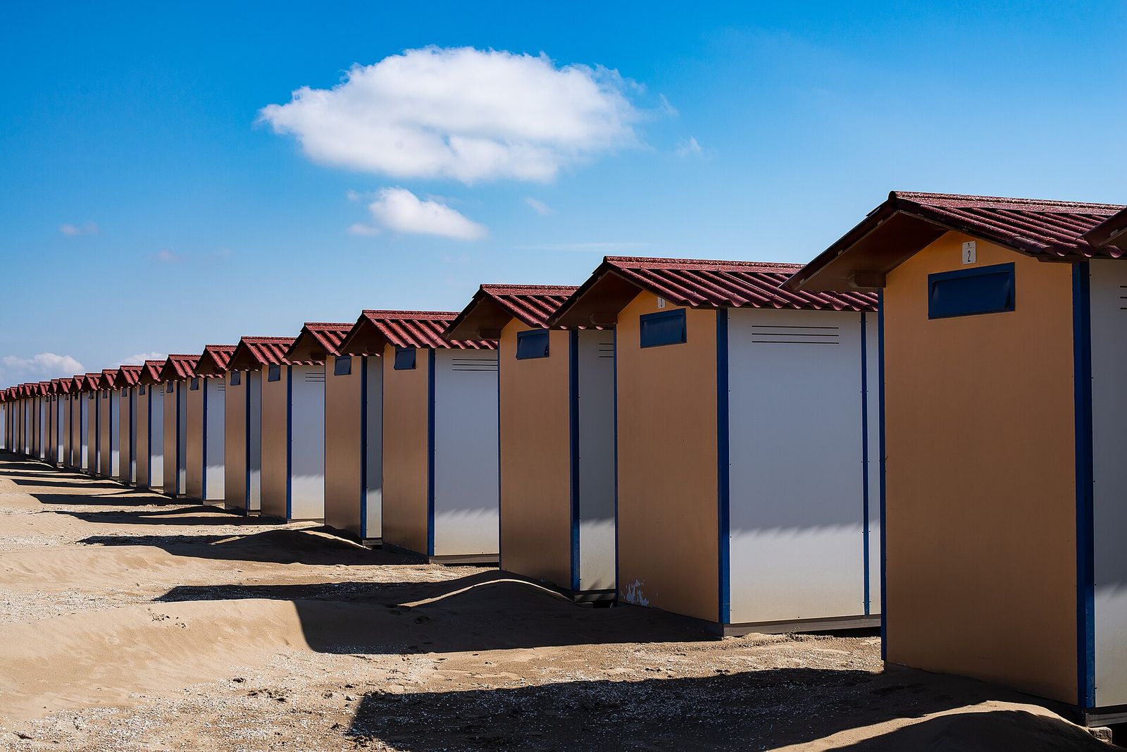
The sea side of the island is one long, gently shelving sandy beach. Much of the central stretch is divided into bathing concessions with rows of wooden cabins, while large public beaches lie towards the northern and southern ends.
Liberty villas
The Lido grew into a seaside resort in the second half of the nineteenth century, and its most striking buildings date from the decades around 1900. In the side streets off the Gran Viale and along the sea front stand villas in the Liberty style, the Italian form of Art Nouveau, with wrought-iron balconies, painted friezes and coloured tiles. Most are private homes, best admired from the street.
The film festival
Every year from late August into early September the Lido hosts the Venice International Film Festival, organised by La Biennale di Venezia. First held in 1932, it is the oldest film festival in the world. Screenings take place in and around the Palazzo del Cinema on the sea front, opened in 1937. For the rest of the year the area is a quiet residential quarter.
The old Jewish cemetery and San Nicolò
Near the northern end of the island lies the old Jewish cemetery. In 1386 the Republic granted Venice’s Jewish community a plot of land here for burials, and many of the tombstones carry Hebrew inscriptions and carved family emblems. Access is limited, usually to guided visits, so check the official information of the Jewish Museum of Venice before you go.
Close to the Lido inlet stands the church of San Nicolò, founded in the eleventh century. Here the doge heard mass on Ascension Day after the Marriage of the Sea, when he cast a ring into the Adriatic from the state barge; a version of the ceremony is still held every year.
Malamocco and the Alberoni
Halfway down the island, on the lagoon side, Malamocco feels like a small piece of Venice that drifted south: a canal, brick bridges, a campo with a church and its bell tower. Its name recalls Metamauco, an older town that was for a time the seat of the doges in the eighth century, before the government moved to Rialto in 811. A storm surge swallowed it in the early twelfth century, and the village was rebuilt where it stands today.
Further south, the Alberoni end of the island is wilder. Behind the beach, dunes up to about 10 m high and a pine wood of some 30 hectares form a protected oasis. At the very tip a long stone breakwater runs out beside the Malamocco inlet, the passage used by large ships heading for the industrial port on the mainland.
The Murazzi
Where the sandbars are thinnest, sand alone was never enough. In the eighteenth century the Republic built the Murazzi, massive sea walls of Istrian stone, along the sea side of Pellestrina and the southern Lido. The main works began in the 1740s under the engineer Bernardino Zendrini and were completed in 1782. On Pellestrina the wall runs for about 10 km, almost the whole length of the island.
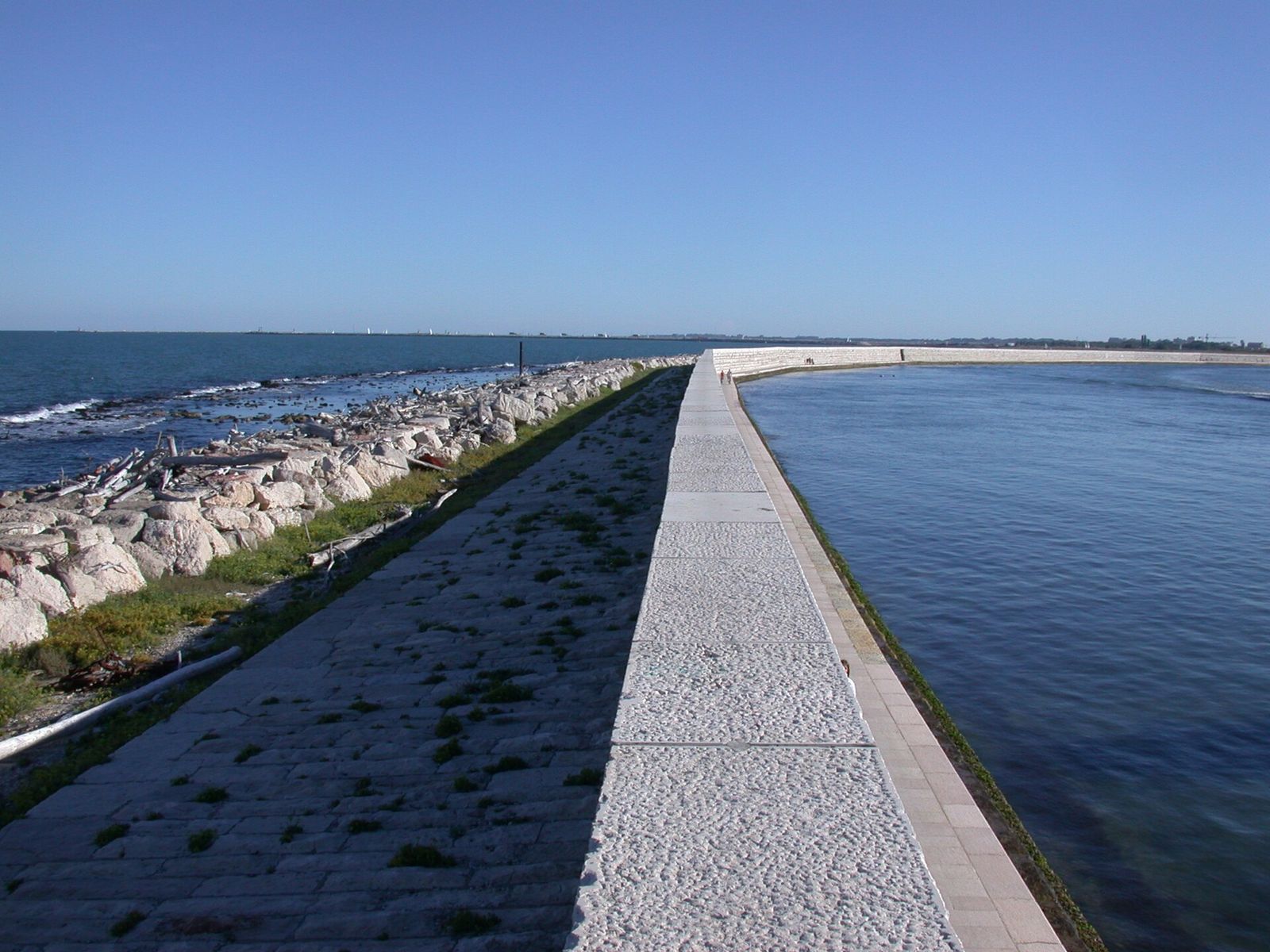
The walls held for almost two centuries. On 4 November 1966, during the highest tide ever recorded in Venice, storm waves broke through the Murazzi at several points and the sea poured across Pellestrina into the lagoon. The breaches were repaired and the defences reinforced, but on a windy day, with waves on one side and village roofs on the other, you see how thin the line is.
Pellestrina and Ca’ Roman
Pellestrina is a different world from the Lido. A single road runs its length, with the sea wall on one side and the lagoon on the other. Along the lagoon shore lie the villages of San Pietro in Volta, Portosecco and Pellestrina itself: brightly painted houses, small boatyards and boats moored opposite front doors. Fishing still shapes daily life. The houses face the lagoon rather than the sea, and for good reason: the lagoon was the road to market, the sea was the danger.
At the southern tip, Ca’ Roman is a nature reserve of dunes, pine wood and beach, protected since 2012. Shorebirds nest on the sand in spring, so keep to the marked paths. From the southern end of Pellestrina a passenger boat crosses to Chioggia, described on our islands of the lagoon page.
End to end by bicycle
Both islands are flat, and a bicycle is the best way to see them. Bicycles are not allowed in the historic centre, so start on the Lido, where bikes can be hired near the main landing stage. A favourite full-day route runs from the northern end of the Lido to the Alberoni, crosses to Pellestrina on the ferry, follows the Murazzi road south to Ca’ Roman and finishes with the boat to Chioggia: roughly 25 km of riding, plus the crossings.
How to get there
Several water-bus lines link the city with the Lido. Pellestrina is reached by a bus that runs the length of the Lido and drives onto a short ferry across the Malamocco inlet. Journey times are typical.
Route card
San ZaccariatoLido S. M. Elisabetta
Tip
San Zaccaria has several platforms; not every boat from there goes to the Lido.
Route card
Lido S. M. ElisabettatoPellestrina
Tip
The bus boards the ferry at the Alberoni, so you can stay on board to Pellestrina.
Route card
PellestrinatoChioggia
Tip
Going on to Chioggia saves retracing your steps along both islands.
Timetables change with the seasons and services are reduced in winter. Check the public transport operator’s official information before you travel. Our guide to getting around by water explains how the stops work.
Questions visitors ask
Can I swim at the Lido?
Yes. The sea side of the island is a long sandy beach, with public stretches towards both ends. Swimming in the city’s canals, by contrast, is forbidden.
Are the islands worth visiting out of season?
Yes, if you like quiet. Between autumn and spring the beaches empty, most bathing concessions close and Pellestrina belongs almost entirely to its residents.
What is the Lido like during the film festival?
Busier, with crowds and barriers around the Palazzo del Cinema and fuller boats. Check the festival’s official information for public events and access.